Best Free Resources for Traders in 2025: From Charts to AI Alerts
December 01 , 2025
Mount St. Helens, one of America’s most famous volcanoes, is remembered for its devastating 1980 eruption. This article explores its history, geology, eruption timeline, and how it continues to shape science and the environment.
Mount St. Helens, located in Washington State in the Pacific Northwest, is one of the most famous volcanoes in the United States. Known for its catastrophic eruption on May 18, 1980, it remains a symbol of natural power and geological change. Rising in the Cascade Range, Mount St. Helens has been closely studied by scientists, visited by millions of tourists, and remembered as a turning point in how Americans view volcanic hazards. Both “Mount St. Helens” and “Mount Saint Helens” are common spellings, though the shorter version is most often used.
Mount St. Helens is part of the Cascade Volcanic Arc, a chain of volcanoes stretching from northern California through Oregon and Washington into British Columbia. These volcanoes are formed by the subduction of the Juan de Fuca Plate beneath the North American Plate. This tectonic activity generates magma, which rises to the surface and builds volcanic mountains like Mount St. Helens, Mount Rainier, and Mount Hood. Known as a stratovolcano, Mount St. Helens is characterized by steep slopes, layers of hardened lava, and explosive eruption potential.
The eruption of Mount St. Helens on May 18, 1980, was the deadliest and most economically destructive volcanic event in U.S. history. Leading up to the eruption, the mountain experienced two months of earthquakes, steam venting, and a growing bulge on its north flank caused by magma buildup. On the morning of May 18, a massive earthquake triggered a landslide, the largest in recorded history, which released the pressure inside the volcano. This caused a lateral blast that destroyed forests, rivers, and towns in its path.
The eruption killed 57 people, destroyed over 200 homes, and devastated nearly 150 square miles of forest. Ash from the eruption reached as far as the Midwest and even disrupted air travel across the country. The mountain itself lost about 1,300 feet of elevation as its summit collapsed into a crater. Images of the eruption, with its massive ash plume rising into the sky, became iconic symbols of nature’s destructive force.
The eruption transformed the landscape dramatically. Spirit Lake, once a popular recreation site, was completely altered and filled with debris. Rivers were clogged with ash and logs, increasing the risk of flooding. Wildlife in the blast zone was wiped out, and forests were flattened in seconds. Yet within a few years, scientists observed signs of ecological recovery. Plants began to regrow, animals returned, and the area became a natural laboratory for studying how ecosystems rebound after devastation.
The U.S. government established the Mount St. Helens National Volcanic Monument in 1982 to preserve the area and allow scientists to study its recovery. Today, visitors can see both the scars of destruction and the resilience of nature in the regrowth of plants, trees, and wildlife populations.
The 1980 eruption revolutionized the study of volcanology. Scientists learned valuable lessons about monitoring volcanic activity, predicting eruptions, and understanding the warning signs of danger. Instruments such as seismographs, gas sensors, and satellite imagery have since been used more effectively at Mount St. Helens and other volcanoes around the world.
The eruption also highlighted the importance of public communication during natural disasters. Despite warnings, some residents and reporters stayed too close to the volcano, leading to tragic losses. Today, public safety protocols are stronger because of what was learned at Mount St. Helens.
Mount St. Helens has not remained quiet since 1980. Between 1980 and 1986, the volcano experienced a series of smaller eruptions that gradually built a lava dome inside its crater. More dome-building eruptions occurred from 2004 to 2008, reminding scientists and locals that the volcano remains active. These smaller eruptions did not produce the widespread devastation of 1980 but reinforced the need for continuous monitoring.
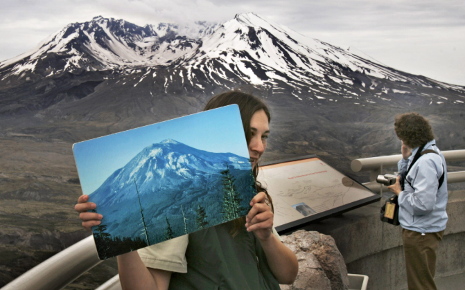
Today, Mount St. Helens is both a scientific research site and a popular tourist destination. The mountain is part of the Gifford Pinchot National Forest and includes visitor centers, hiking trails, and observation areas. Johnston Ridge Observatory, named after volcanologist David A. Johnston who lost his life in the 1980 eruption, offers educational exhibits and panoramic views of the crater.
Tourists flock to the area to witness firsthand the power of the eruption and the ongoing recovery of the landscape. Activities include hiking, photography, educational tours, and scientific workshops. The mountain stands as a reminder of both destruction and rebirth, drawing curiosity and respect from people worldwide.
The recovery of the Mount St. Helens area has provided insight into how life returns after catastrophic events. The regrowth of forests, the return of elk herds, and the reestablishment of aquatic life in rivers and lakes all demonstrate nature’s resilience. Scientists continue to study soil development, plant colonization, and wildlife adaptation in the region. These lessons extend beyond Mount St. Helens, offering clues about recovery from other natural disasters like wildfires, hurricanes, and floods.
Mount St. Helens holds cultural significance for Native American tribes in the region, who have long told stories about the mountain’s power. For modern society, it stands as both a tragedy and an educational tool. School curriculums often include lessons about the eruption to teach students about geology, ecology, and emergency preparedness. The images of the 1980 eruption remain some of the most widely recognized in natural history.
Mount St. Helens remains the most active volcano in the Cascades, and scientists expect it to erupt again in the future. While it is unlikely to produce an explosion on the scale of 1980 in the immediate future, smaller eruptions are possible. Continuous monitoring by the U.S. Geological Survey helps track seismic activity, gas emissions, and ground deformation, ensuring that warnings can be issued promptly.
Mount St. Helens is more than just a mountain; it is a living reminder of Earth’s raw power and resilience. From its catastrophic 1980 eruption to the remarkable recovery of its ecosystems, it continues to fascinate scientists, inspire visitors, and educate the world about volcanic hazards. Whether called Mount St. Helens, Mt. St. Helens, or Mount Saint Helens, it remains an iconic symbol of nature’s ability to both destroy and renew.
#MountStHelens #Volcano #Eruption #Cascades #NatureRecovery #Volcanology
December 01 , 2025

December 01 , 2025

December 01 , 2025


December 01 , 2025

December 01 , 2025


December 01 , 2025


December 01 , 2025

November 18 , 2025